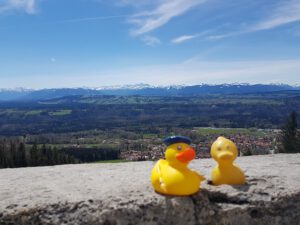
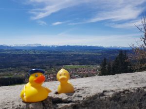
Since the weather prediction was perfect last Saturday, the swarm went on another bicycle trip. We started in Weilheim and spontaneously made a detour up on the “Hohenpeißenberg”. We come here frequently to enjoy the splendid view overlooking the Bavarian Alpine Slope on its northern side. New member of the swarm, Anatra Antonio Canardetto was looking for inspiration so it was his idea to drive up on the Hohenpeiißenberg mountain. Considered the most beautiful panoramic Bavarian Mountain.

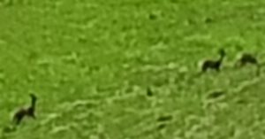
We even saw a group of deer down on the slope of the mountain.
Normally we would enjoy the excellent food of the restaurant here together with the view. But because of Corona it was closed. But they opened a small snack stall here which we attended. And I got us a roll with Wienerschnitzel, a “Auszogne” (Bavarian doughnut) and a “Radler” (beer with lemonade). From Hacker-Pschorr. Hacker-Pschorr operates the big Hacker-Festzelt (beer tent) on the Wiesn (Oktoberfest).
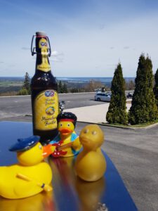
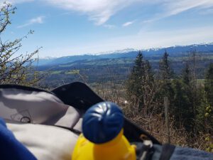
(Radom Raisting visible in the background)
Pschorr was an ancestor of Richard Strauss.
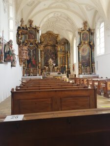
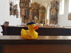
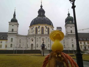
And we also visited the Pilgrimage Church of the Assumption of the Virgin Mary at a perfect spring day. And lighted a candle.
The mountain also is an important outpost for the German Meteorological Network. Weather was observed, documented and filed here since as early as 1781 by the “Augustiner Monks” from nearby Monastery Rottenbuch who also organized the Pilgrimage business. And operated a beer brewery in Munich.
We could see many places from up here which we had visited before:
Estergebirge (mountain range),
Hohenpeißenberg is situated at the left shore of the “Ammer River” who has it’s rise in the Weidmoos south of Oberammergau near Monastery Ettal. Which was our destination for the day.
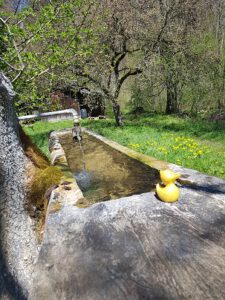
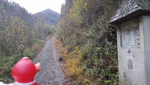
We continued our way south following a sign showing the way to Rottenbuch and the Ammer-Gorge but learned the hard way that the way was only for pedestrians. Therefor I had to push the bike and the swarm for 3 km down into the gorge. Which was kind of dangerous but turning round was no option after I realized the problem. But we made it and were happy after we hit the official bicycle route again down along the Ammer River. We found a cattle fountain and enjoyed some clear water as we did not have any food or water on us.
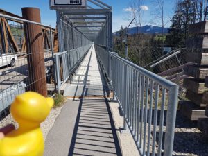
We also had to cross the makeshift Echelsbacher Bridge which is under construction for the next years. They even set up a makeshift bridge for pedestrians and cyclers next to the makeshift bridge for the cars, extremely long and narrow. The longest of its kind in Germany. Cyclers are required to push their bikes across the high bridge as it is very narrow. Sheila kept looking only straight forward.
We used a lot of energy on those detours trying to use as few battery support as our physical abilities allowed us to. And were happy that we reached our destination in Ettal
on the last Watts. The tour had many ascents.
From Ettal we could roll down to Oberau train station on the Ettaler Berg.
Credit: Maps Icons ColIlection, https://mapicons.mapsmarker.com/
![]()